Defence technology · Explained
When GPS Goes Silent: Hyderabad’s GarudaNav and India’s Push for Resilient Drone Navigation
PhoQtek Labs says its GarudaNav module kept a drone navigating under GPS denial at Pokhran. The deeper story is India’s effort to build the sensors, software and autonomy behind the aircraft—not just another airframe.
BharatVox ·
The navigation problem behind the viral drone story
A drone can have a capable airframe, a powerful camera and a carefully planned route—and still lose a crucial reference when satellite positioning becomes unreliable. That is the problem behind The Rocket Media’s October 6 Instagram carousel about Hyderabad-based PhoQtek Labs and its GarudaNav navigation module. The company says it demonstrated autonomous drone operation in GPS-denied conditions at the Indian Air Force’s Dronathon in Pokhran. [1][3]
The most interesting claim is not that India has built another drone. It is that a domestic team is developing an onboard navigation layer that could make existing aircraft less dependent on external positioning signals. Cameras, inertial sensing and computing become part of the aircraft’s ability to understand its own movement when a satellite-derived location cannot be trusted.
There is a promising development here, but also a necessary distinction. Defence Ministry releases confirm the Dronathon and its emphasis on contested environments; the particular GarudaNav flight is described by PhoQtek and its founder. The publicly available material reviewed for this article does not include an independent IAF technical report validating the system’s accuracy, endurance or performance across different conditions. [2][3][4]
BharatVox Graphic
How onboard navigation can reduce reliance on GPS
- 1
Cameras
Observe
Observe the environment. The founder confirms cameras; detailed visual algorithms are not publicly validated.
- 2
Inertial sensors
Measure motion
Gyroscopes and inertial measurements contribute movement information.
- 3
Edge computing
Combine
The company describes onboard processing and proprietary navigation software.
- 4
Autonomous execution
Navigate
The company reports a short GPS-denied flight; this is not an independent performance certification.
What happened at Pokhran—and what the official record says
The first IAF Dronathon ran from September 14 to 16, 2026 at the Pokhran Field Firing Range in Jaisalmer. Air Marshal Ashutosh Dixit, Vice Chief of the Air Staff, inaugurated it. The Defence Ministry reported participation by more than 20 defence companies, startups, MSMEs, public-sector undertakings and innovators, with demonstrations spanning surveillance, autonomy, swarms, electronic warfare and counter-drone systems. [2]
Its stated purpose was to move from technology demonstration to operational effect. That matters: a drone that flies successfully in a benign setting is not necessarily useful in a contested one. Reliability, effectiveness and adaptation to evolving threats were explicitly part of the assessment agenda. The IAF also released a UAS Roadmap intended to give industry clearer capability priorities. [2]
In an October 8 interview with The New Indian Express, PhoQtek founder and CEO Gautham Nekkanti described a short GPS-denied mission conducted within the permissions granted by the Air Force. He said his company was the only participant to perform such a test during the three-day event. A September 22 founder post likewise describes autonomous operation amid electronic jamming, including position holding and trajectory following. These are attributable first-party accounts, not independently published comparative test results. [3][4]
PhoQtek’s own website now identifies GarudaNAV’s field testing at Pokhran and says navigation remained on its system while GNSS was denied. The same site labels its core technologies ‘Under Staged Development’. It is therefore more accurate to describe an active development and validation programme than to announce a universally proven, fielded product. [5]
Slide four’s question: how can a drone know where it is without GPS?
The fourth slide in the supplied carousel names GarudaNav and describes a combination of cameras, inertial sensors, visual-inertial odometry, simultaneous localisation and mapping—usually shortened to SLAM—and a small onboard computer. It is a useful conceptual explanation, but the publicly retrieved company material and founder interview confirm the broader camera, inertial-sensing and edge-computing architecture rather than every named software technique. The precise implementation remains a company disclosure question. [1][3][5]
In general, visual navigation uses changes in what a camera sees to help estimate motion relative to the surrounding environment. Inertial sensors contribute information about rotation and acceleration. Combining different measurements can reduce dependence on any single source, while onboard processing allows the aircraft to update its estimate without sending every observation to a remote computer.
Nekkanti says PhoQtek uses selected cameras, gyroscopes, inertial sensors and a proprietary algorithm, with AI and edge computing supporting autonomous mission execution. That explains the broad engineering direction. It does not establish a specific processor, a published SLAM benchmark or a guaranteed level of accuracy. [3]
Nor does GPS-free mean sensor-free or error-free. Visual observations depend on the scene and operating conditions; inertial estimates accumulate error over time. A robust navigation system must manage uncertainty, not merely display a position. Any claim of reliable operation across night, desert, mountains and sea needs evidence from those environments, not extrapolation from one short demonstration.
Jamming, spoofing and a lost control link are different problems
The carousel groups together GPS signals being jammed or faked. The distinction is important. Jamming interferes with reception; spoofing attempts to make a receiver accept misleading positioning information. Both can compromise satellite-dependent navigation, but a demonstration under one condition does not automatically establish resistance to the other.
A satellite-navigation link and a command-and-control link are also not the same thing. Losing position information does not necessarily mean losing radio contact with an operator, and losing radio contact does not necessarily remove an onboard position estimate. The source post claims operation without satellite signals and a link back to base; the reviewed public record does not provide enough test detail to establish uninterrupted, complete denial of both throughout the mission. [1][3][4]
It would also be wrong to say every drone must crash or drift uncontrollably when GPS fails. ArduPilot’s documentation describes a dead-reckoning failsafe that can support a full or partial return after position loss, depending on configuration and how long the estimate remains useful. Such fallback behaviour has limits, but its existence makes the carousel’s blanket claim too broad. GarudaNav’s significance should be judged by demonstrated resilience, not by assuming other aircraft have none. [6]
Retrofitting the brain: why the business model matters
PhoQtek’s founder describes GarudaNav as an indigenous, retrofittable module for platforms the military already possesses. He says the goal is to avoid requiring users to replace their entire software stack or undergo a lengthy integration process. That is a different commercial proposition from selling a complete new aircraft. [3]
If demonstrated across appropriate platforms, a navigation module could create value through upgrades rather than wholesale fleet replacement. It would allow airframe manufacturers, system integrators and specialist sensor companies to contribute different parts of a capability. The potential benefit is economic as well as strategic: a competitive domestic ecosystem can build expertise in components and software that remain important even when aircraft designs change.
Compatibility, however, is something to prove platform by platform. The Instagram carousel says GarudaNav works with popular open-source autopilots and aircraft weighing several hundred kilograms. The public sources reviewed here do not supply named controllers, interface specifications, integration tests or a validated aircraft-weight envelope. Those assertions remain claims in the social post, not established product specifications. [1]
The founder describes 20–100 kilometres of navigation capability as the company’s long-range focus and roughly 250 metres to one kilometre as a baseline altitude range. Those figures describe the intended development focus in the interview; they are not measured results from the short Pokhran flight. [3]
A broader Indian autonomy ecosystem, not a single miracle device
The Defence Ministry’s Dronathon account explicitly extends self-reliance beyond airframes to propulsion, sensors, payloads, communications, autonomy, electronic warfare, countermeasures and airspace management. GarudaNav’s navigation-layer approach fits that broader direction, even though its particular performance still needs independent documentation. [2]
One officially described opening-day demonstration was Vayu UTtaM, the IAF’s indigenous multi-mode unmanned traffic-management system, which detected and tracked military and civil unmanned aircraft. Its role is different from onboard navigation: it concerns coordinated airspace management and identifying unauthorised or rogue drones. The two should not be conflated simply because they appeared at the same event. [2]
PhoQtek also lists fibre-optic gyroscopes and a navigation software stack alongside visual navigation. Its founder distinguishes gyroscope work oriented towards land and naval applications from GarudaNav’s aerial focus. These are related navigation efforts, not evidence that every product is mature or that one demonstrator validates all three. [3][5]
From a promising flight to dependable capability
The next meaningful milestone is not a more dramatic social-media headline. It is repeatable evidence: navigation error over time, mission duration, operating conditions, sensor limitations, behaviour when confidence falls and the outcome of repeated trials. A public summary need not reveal sensitive engineering details to distinguish a development demonstration from an operationally qualified capability.
Nekkanti’s interview identifies daytime and nighttime operations and work across desert, mountain and maritime environments as part of the roadmap. Surveillance, logistics and disaster response are plausible application areas, but plausibility is not deployment. The company’s stated willingness to pursue prototype demonstrators and platform-specific validation on its website is consistent with further work ahead. [3][5]
Autonomy also needs clear accountability. An aircraft that continues without external guidance must remain within authorised mission boundaries and have appropriately tested safety behaviour. Navigation resilience is not a licence to assume unrestricted autonomous decision-making, and proposed military applications should not be confused with a demonstrated autonomous weapon system.
BharatVox View: self-reliance grows in the parts we cannot see
India’s defence-technology ambition deserves to be measured beyond the silhouette of a drone. Sensors, algorithms, integration knowledge and rigorous testing are often less photogenic than an aircraft, but they can determine whether it remains useful when external dependencies are disrupted. A Hyderabad team tackling that problem is worth serious attention.
The strongest case for indigenous innovation is not exaggerated certainty. It is a competitive environment in which domestic specialists can demonstrate capability, win users’ confidence and improve through demanding trials. Public institutions can define needs and evaluate performance; private firms can compete to deliver the best solution. That combination better serves national security than treating a prototype as a finished revolution.
GarudaNav’s reported Pokhran flight is an encouraging step in that direction. The next chapter should be written through independently documented testing and reliable deployment. Giving Indian engineering its due means taking its promise seriously—and holding the evidence to the standard that dependable defence systems require.
Source and visual notes
This feature follows all seven images returned by the supplied Instagram carousel: the artwork is numbered 1/8 through 6/8, followed by 8/8. A page marked 7/8 was not available in the retrieved post. The article does not infer its contents. The carousel’s January 2025 incorporation date has not been checked against an official company record and is not treated here as verified history. [1]
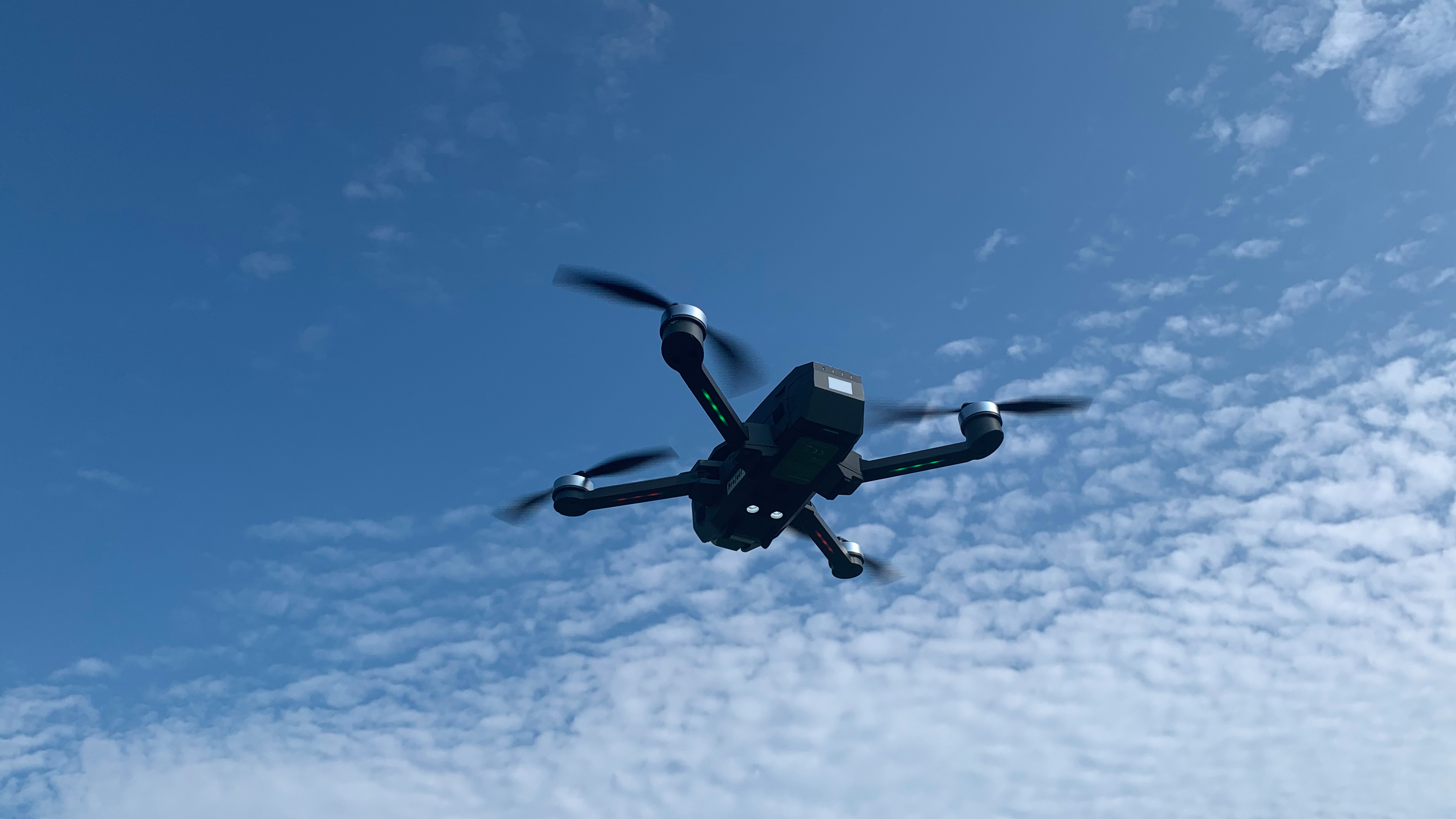
The photograph is a licensed archive image of a quadcopter in flight, not GarudaNav, an Indian military aircraft or the Pokhran test. The diagrams and tables are original BharatVox explanations derived from the linked sources, not flight telemetry or copied publisher graphics. Product-specific photographs and carousel artwork are not reproduced because reuse permission was not established.
BharatVox Data
Three different failures—not one lost signal
| GPS/GNSS jamming | Reception disrupted | Interference prevents dependable satellite positioning. |
|---|---|---|
| GPS/GNSS spoofing | False position information | A receiver may be misled; anti-jamming performance alone does not prove anti-spoofing performance. |
| Control-link loss | Operator contact disrupted | A separate communications problem; not automatically the same as losing satellite positioning. |
BharatVox Data
GarudaNav: demonstration versus development ambition
| Pokhran mission | Short flight | Founder-reported GPS-denied mission within Air Force permissions; duration and error data not publicly supplied. |
|---|---|---|
| Long-range focus | 20–100 km | Company development focus described in the interview—not the reported test distance. |
| Baseline altitude focus | 250 m–1 km | Founder-described target range, not a certified operational envelope. |
| Additional environments | Day/night; desert/mountain/sea | Roadmap described by the founder, not a completed set of validation trials. |
Sources & further reading
- [1]The Rocket Media: PhoQtek GPS-denied drone carousel, 6 October 2026
- [2]Ministry of Defence: Indian Air Force Dronathon 2026, 14 September 2026
- [3]The New Indian Express: Out-of-the-box Hyderabad—Keeping drones on mission when GPS fails, 8 October 2026
- [4]Gautham Nekkanti: first-party Dronathon demonstration account, 22 September 2026
- [5]PhoQtek Labs: navigation technologies, staged development and Pokhran field testing
- [6]ArduPilot: Dead Reckoning Failsafe documentation
- [7]Ministry of Defence: Dronathon event announcement, 8 September 2026
How it unfolded
Timeline
8 September 2026
Defence Ministry announces the upcoming IAF Dronathon at Pokhran.
14–16 September 2026
Official event dates; PhoQtek reports a short GPS-denied demonstration during Dronathon.
6 October 2026
The Rocket Media publishes the GarudaNav carousel.
8 October 2026
Founder interview explains sensors, retrofit strategy and development priorities.
Fact-check this story · Source: The Rocket Media; Ministry of Defence; PhoQtek Labs; The New Indian Express: PhoQtek GarudaNav GPS-denied navigation: carousel, official event record and founder interview. This AI-assisted account is based on the linked source, not independent on-the-ground reporting by BharatVox. Any opinion is separately labelled.
Join the conversation (0)
Sign in to share your view on this story.